
MEDIA ADVISORY: High-Level NOAA Official to Make Rare Visit to LSU Tuesday, Feb. 20
February 19, 2024
BATON ROUGE – Head of the National Oceanic and Atmospheric Administration and Under Secretary of Commerce for Oceans and Atmosphere Richard W. Spinrad will make a rare visit to LSU on Tuesday, Feb. 20, to recognize LSU’s nation-leading coastal and oceanographic work.
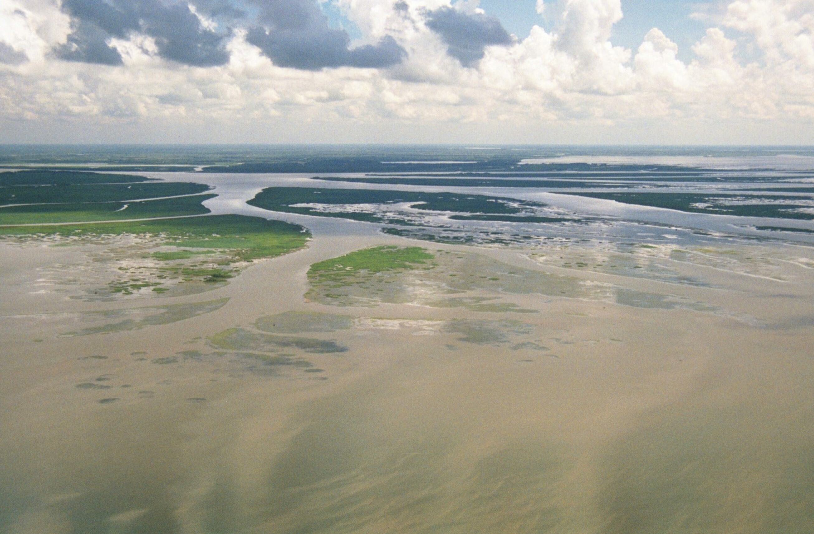
The Mississippi River Delta meets the Gulf of Mexico.
He will begin his visit at 11 a.m. at the Water Campus located at 1110 S. River Rd. in Baton Rouge. Media are invited to attend, and free parking is available in the lot across the street from the entrance ramp. More details on the visit are below.
Spinrad’s visit is happening in conjunction with the leading ocean sciences conference in the world, the Ocean Sciences Meeting, held in New Orleans this week. More than 100 LSU faculty, students and staff will present at the conference, showcasing LSU’s work to protect coastal land and communities under its Scholarship First Agenda. Spinrad will hold a session at the conference on Wednesday, Feb. 21.
Members of the media can register to attend the Ocean Sciences Meeting for free. The on-site press room is located on the second floor of the Ernest N. Morial Convention Center, Room 212, and LSU’s booth at the conference is #503 in the Convention Center. Access the full program of LSU research presentations here.
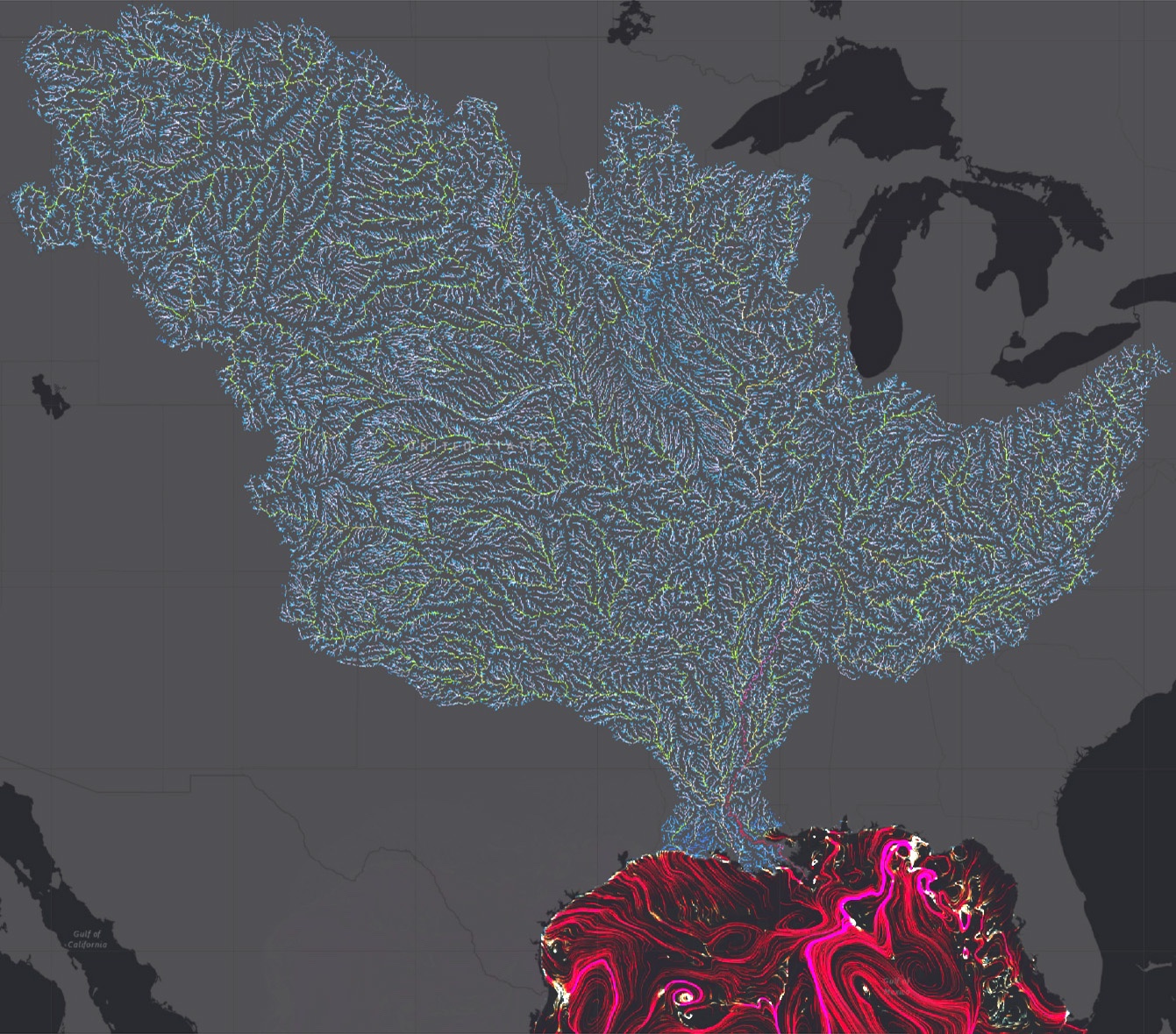
Researcher Xiaochen Zhao and Associate Professor Z. George Xue in the LSU Department of Oceanography & Coastal Sciences, with Xue having a joint appointment in the LSU Center for Computation & Technology, will present research by their Coupled Ocean Modeling Group at the Ocean Sciences Meeting, including “A High-resolution Process-based Hydrological and Sediment Modeling System for the Mississippi River Basin.” Pictured here is the streamflow of the vast Mississippi River Basin, which drains 40 percent of the United States into the Gulf of Mexico.
NOAA Head Spinrad’s Visit to LSU – Additional Details and Background:
On Tuesday, Feb. 20, Spinrad will start his day on the Water Campus at 11 a.m. with visits to the LSU Coastal Ecosystem Design Studio, which collaborates with communities and decision-makers on resilience projects, and the LSU Center for River Studies, which houses one of the world’s largest movable bed physical models for research and education and can simulate an entire year of the flow, water levels and sediment transport of the Mississippi River in one hour.
In the afternoon, Spinrad will tour the LSU College of the Coast & Environment and Louisiana Sea Grant, which leads two NOAA-funded projects to address marine debris as well as other projects supported by NOAA. LSU is one of few universities in the country that simultaneously hold sea-, space- and land-grant designations.
LSU has received as many as 35 research awards from NOAA over the past five years, including 12 Knauss Marine Policy Fellowships, a testament to the university’s ability to produce useful knowledge and solutions and educate the next generation of coastal experts. Multiple grants support modeling efforts to predict the future of our coasts and the increasing effects of storm surge and sea level rise. Funded projects include Kehui Xu’s and Z. George Xue’s “Coupled Ocean Modeling Testbed Platform for Physics and Contaminant Exchange through the River - Estuary - Ocean Continuum” — with both researchers presenting at the Ocean Sciences Meeting this week — and Chris Kees’ “Integrated Modeling of the Effects of Sea Level Rise Across Estuaries, Marshes and Barrier Islands.”
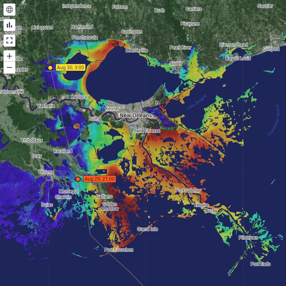
LSU’s CERA website showed projected storm surge at high resolution and accuracy ahead of Hurricane Ida in August 2021.
“There is no ‘everything model’ that is always applicable and can cover all of the coastal zone across all space and time scales, and that’s why our multiple modeling efforts are so necessary and dovetail so nicely together for coastal planning and design,” Kees said. “Together, our projects help meet multiple objectives for different people and organizations — from an evacuation plan in response to an approaching hurricane to a 100-year flood protection design in response to sea level rise.”
Examples of LSU coastal modeling products available online include the Coastal Emergency Risks Assessment, or CERA, and the Gulf of Mexico Coastal Hazards Forecast System, which both rely on NOAA data and support. The former serves Louisiana’s Coastal Protection and Restoration Authority and thousands of first responders and emergency managers across the nation in their urgent preparations for storm surge and flooding ahead of hurricanes and major weather events, while the latter recently came online to provide a 72-hour coupled river and ocean forecast, including key conditions such as flooding, both riverine and compound; hurricanes, with wave and sea level changes; saltwater intrusion; hypoxia; and ocean acidification — with ongoing development to predict potential impacts of oil and chemical spills and more.
“The NOAA Storm Surge Modeling Team relies on LSU’s CERA storm surge forecasting framework and visualization capability that enables the connection between ongoing research and development of NOAA’s Surge and Tide Operational Forecast System, or STOFS, with the final operational nowCOAST visualization product,” said Edward P. Myers III, chief of the Coastal Marine Modeling Branch of NOAA’s Office of Coast Survey, which has been working in close partnership with LSU since 2022. “This strong partnership between NOAA and LSU includes code, data and information exchange as well as real-time support for STOFS research to operations.”
“At LSU, our coastal research results represent the point of the spear in preparing for a challenging future,” said Robert Twilley, LSU vice president of research and economic development. “Our faculty and students study problems and design solutions today for coastal ecosystems and communities right here in the Mississippi River Delta that will be used globally over the next 50 years because of accelerated relative sea level rise. That’s why our modeling tools, especially, are so important. We’re the testbed of a dynamic future.”