NOAA Awards $3.1 Million Grant to LSU C4G for Geospatial Modeling
November 5, 2018
 BATON ROUGE, LA – LSU’s Center for GeoInformatics, in its role as the Louisiana Spatial
Reference Center, has been awarded a $3.1 million grant over the next five years from
the National Oceanic and Atmospheric Administration for its support in regional geospatial
modeling.
BATON ROUGE, LA – LSU’s Center for GeoInformatics, in its role as the Louisiana Spatial
Reference Center, has been awarded a $3.1 million grant over the next five years from
the National Oceanic and Atmospheric Administration for its support in regional geospatial
modeling.
The purpose of the grant is to help improve and modernize the NOAA’s National Spatial Reference System—a consistent, coordinate system that defines latitude, longitude, height, scale, gravity, and orientation throughout the United States. The NSRS is used by surveyors and others to create maps; mark off property boundaries; plan, design, and build roads, bridges, and other structures; and ensure that positional coordinates are compatible with those determined by others.
The goal is to develop models with accuracies better than 2 cm, or 3/4 of an inch. The dynamic nature of Louisiana’s geology makes it an outlier when continental geodetic models are developed, with many negative results for Louisiana. The NOAA grant will allow LSU C4G to build on its work to bring Louisiana, and the Gulf Coast, in line with the rest of the country, ensuring accurate geoid models, flood mapping, coastal studies, levee construction, and public safety in general.
“This project will enhance C4G efforts to maintain and modernize the spatial reference system of elevations for Louisiana and the coastal region of the Gulf of Mexico,” said Boyd Professor George Voyiadjis, principal investigator on the project, director of C4G and chair of the LSU Department of Civil and Environmental Engineering. “In particular, our work involves observations of absolute and relative gravity, as part of the legacy of the LSU system, for tracking subsidence rates in Louisiana.”
Voyiadjis is joined on the project by co-investigators Randy Osborne, Clifford Mugnier and J. Anthony Cavell. Larry Dunaway and Jon Cliburn round out the team.
The grant was awarded in collaboration with a continuing five-year, Gulf Coast-wide partnership with the University of Southern Mississippi’s Gulf Coast Geospatial Center, the Alabama Department of Transportation, the University of Florida, and Texas A&M University-Corpus Christi’s Texas Spatial Reference Center in the Conrad Blucher Institute for Surveying and Science.
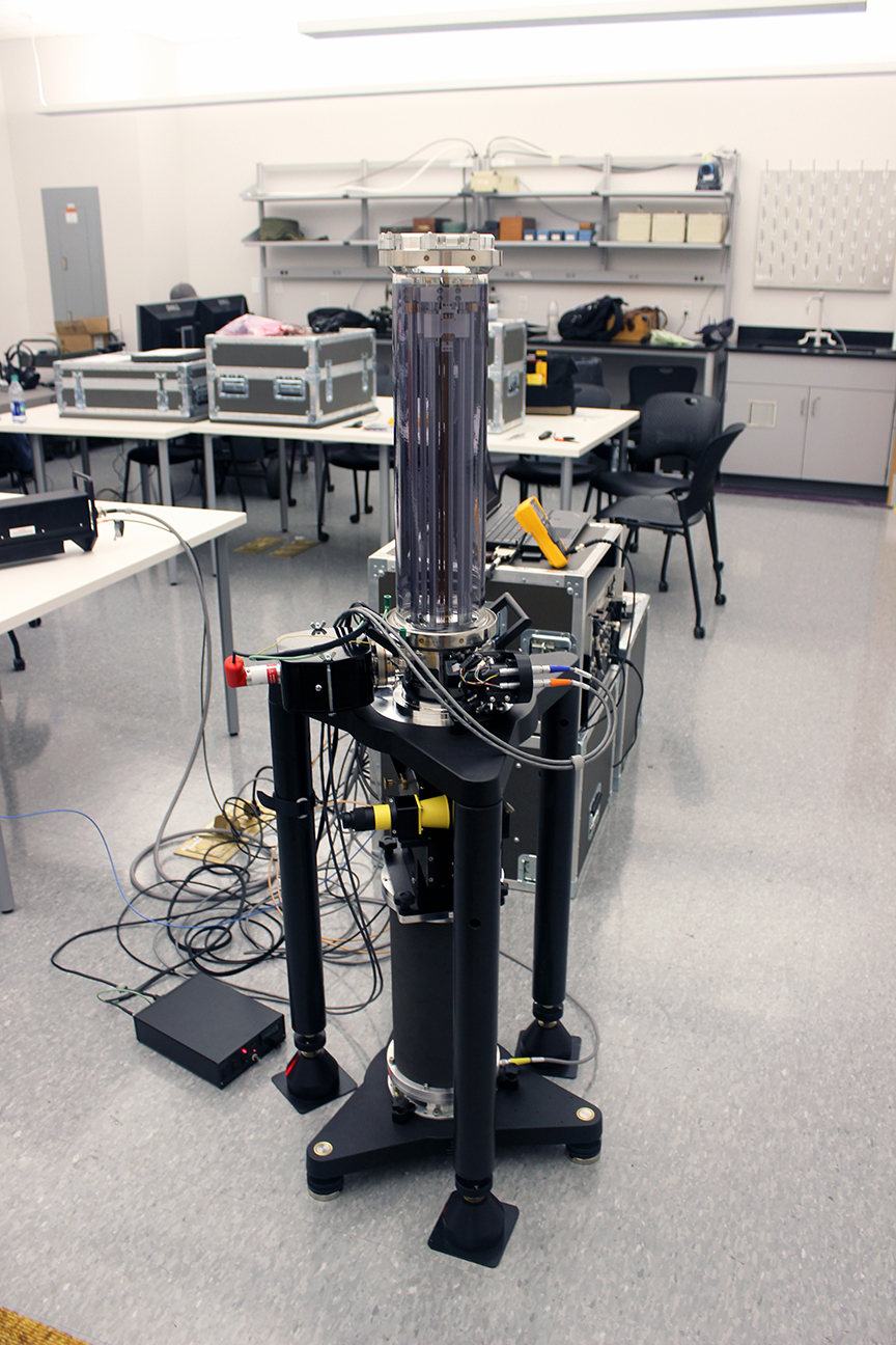
Several newly acquired pieces of equipment will be used in C4G’s work, including a self-funded $400,000 Absolute Gravity Meter, which will be deployed to collect terrestrial gravity measurements, and a $100,000 Digital Zenith camera from the Institute of Geodesy and Geoinformatics at the University of Latvia. The camera will identify vertical deflection, which is a measure of how far gravity direction shifts due to local anomalies and helps increase the accuracy of local surveys of the Earth’s gravity field.
About the Center for Geoinformatics
The C4G was created in 2001 to build new research and services in geodesy and geoinformatics for the geodetic and geophysical communities. In cooperation with the NOAA’s National Geodetic Survey, the C4G founded the Louisiana Spatial Reference Center in 2002 as a partnership focused on a state-of-the-art positional infrastructure for the state of Louisiana and to provide technical leadership, training, and access to positional data. The LSRC is responsible for the network of Global Navigation Satellite System control stations, a reliable spatial reference system in Louisiana.
Like us on Facebook (@lsuengineering) or follow us on Twitter and Instagram (@lsuengineering).
###
Contact: Joshua Duplechain
Director of Communications
225-578-5706 (o)