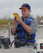
Robert Paulsell
Research Associate 4
Email: rpaulsell@lsu.edu
Telephone: 225-578-8655
Robert received a B.S. in Geography from LSU in 1987 and initially worked for St. Tammany Parish Police Jury designing and implementing a rural municipal addressing system for Enhanced 911. He joined the LGS in October of 1990 assisting with map production utilizing traditional cartographic methods. His specialties are geographic information systems data development and cartographic production. His has experience with global navigation satellite systems (GNSS) data collection in his efforts to map petrochemical pipelines in Louisiana. Robert is responsible for the coordination and development of spatial data, derivative GIS and cartographic products, and web site development and maintenance.
"I became interested in mapping as a result of flying to and from South America when I was young. I was intrigued by the mountains and oceans with their fascinating shapes and vivid colors." (rlp 2016)
Select Publications/Reports (GIS data development and GPS data collection)
The Mississippi River Source to Sink System: Perspectives on Tectonic, Climatic, and Anthropogenic Influences, Miocene to Anthropocene. A Source-to-Sink Systems. S.J. Bentley Sr., M.D. Blum, J. Maloney, L. Pond, R. Paulsell, 2015, Earth Science Reviews 153, 2016, 139-174.
Investigation and GIS development of the buried Holocene-Pleistocene surface in the Louisiana coastal plain. Heinrich, P. V., Paulsell, R., Milner, R., Snead, J. I., and Peele, R. H., 2015, Report by Louisiana Geological Survey for Coastal Protection and Restoration Authority of Louisiana.
Response of Late Quaternary Stream and Estuarine Systems to Holocene Sea Level Rise on the Outer Continental Shelf Offshore Louisiana and Texas: Preservation Potential of Paleolandscapes and Identification of Sand resources for Coastal restoration. Heinrich, P. V., Paulsell, R., Miner, M., McCulloh, R. P., and Milner, R.. Draft report by Louisiana Geological Survey Bureau for the Bureau of Ocean Energy Management, U.S. Department of Interior, Metairie, Louisiana (in review).
Research and Development of a GIS of Oil, Gas, and Petrochemical Pipelines in between New Orleans and Baton Rouge, Louisiana. R. L. Paulsell, 2008, Louisiana Oil Spill Coordinator’s Office; Louisiana Applied and Educational Oil Spill Research and Development Program.
Field Investigation and Digital Mapping of Pipeline Crossings of The Coastal Zone Navigation Channels in Louisiana. J. I. Snead, R. L. Paulsell, and W. Feng, 2007, Applied and Educational Oil Spill Research and Development Program.
Research and Development of a GIS of Oil, Gas, and Petrochemical Pipelines in the Lafayette, Louisiana vicinity. R. L. Paulsell, W. Feng, 2005, Louisiana Oil Spill Coordinator’s Office; Louisiana Applied and Educational Oil Spill Research and Development Program.
Field Investigation and Digital Mapping of Pipeline Crossings of The Intracoastal Waterway in Louisiana. J. I. Snead, R. L. Paulsell, and W. Feng, 2005, Applied and Educational Oil Spill Research and Development Program.
Field Investigation and Digital Mapping of Pipeline Crossings of the Ouachita Black River System. J. I. Snead, R. L. Paulsell, and W. Feng, 2004, Louisiana Office of Emergency Preparedness, Louisiana Applied and Educational Oil Spill Research and Development Program.
Research and Development of a GIS of Oil, Gas, and Petrochemical Pipelines in Lake Charles, Westlake, and Sulphur, Louisiana. R. L. Paulsell, Weiwen Feng, 2004, Louisiana Oil Spill Coordinator’s Office; Louisiana Applied and Educational Oil Spill Research and Development Program.
Select Publications (GIS data development - cartography)
Albany Geologic Quarangle map. 2024. scale 1:24,000. USGS StateMap Award No. G23AS00050
Holden Geologic Quarangle map. 2024. scale 1:24,000. USGS StateMap Award No. G23AS00050
Springfield Geologic Quarangle map. 2024. scale 1:24,000. USGS StateMap Award No. G23AS00050
Frost Geologic Quarangle map. 2024. scale 1:24,000. USGS StateMap Award No. G23AS00050
Convent Geologic Quarangle map. 2023. scale 1:24,000. USGS StateMap Award No. G22AC00379
Luthcher Geologic Quarangle map. 2023. scale 1:24,000. USGS StateMap Award No. G22AC00379
Whitehall Geologic Quarangle map. 2023. scale 1:24,000. USGS StateMap Award No. G22AC00379
Killian Geologic Quarangle map. 2023. scale 1:24,000. USGS StateMap Award No. G22AC00379
Walls Geologic Quarangle map. 2022. scale 1:24,000. USGS StateMap Award No. G21AC10813
Lobdell Geologic Quarangle map. 2022. scale 1:24,000. USGS StateMap Award No. G21AC10813
Addis Geologic Quarangle map. 2022. scale 1:24,000. USGS StateMap Award No. G21AC10813
Gonzales Geologic Quarangle map. 2022. scale 1:24,000. USGS StateMap Award No. G21AC10813
Sorrento Geologic Quarangle map. 2022. scale 1:24,000. USGS StateMap Award No. G21AC10813
Madisonville Geologic Quarangle map. 2021. scale 1:24,000. USGS StateMap Award No. G20AC00239
Covington Geologic Quarangle map. 2021. scale 1:24,000. USGS StateMap Award No. G20AC00239
Nicholson Geologic Quarangle map. 2021. scale 1:24,000. USGS StateMap Award No. G20AC00239
French Settlement Geologic Quadrangle Map. 2020. scale 1:24,000. USGS StateMap Award No. G19AC00223.
Plaquemine Geologic Quadrangle Map. 2020. scale 1:24,000. USGS StateMap Award No. G19AC00223.
Waldheim Geologic Quadrangle Map. 2020. scale 1:24,000. USGS StateMap Award No. G19AC00223.
Walker Geologic Quadrangle Map. 2020. scale 1:24,000. USGS StateMap Award No. G19AC00223.
Breaux Bridge Geologic Quadrangle Map. 2019. scale 1:24,000. USGS StateMap Award No. G18AC00179.
Chipola Geologic Quadrangle Map. 2019. scale 1:24,000. USGS StateMap Award No. G18AC00179.
Pine Grove Geologic Quadrangle Map. 2019. scale 1:24,000. USGS StateMap Award No. G18AC00179.
Satsuma Geologic Quadrangle Map. 2019. scale 1:24,000. USGS StateMap Award No. G18AC00179.
Carencro Geologic Quadrangle Map. 2018. scale 1:24,000. USGS StateMap Award No. G17AS00006.
Duson Geologic Quadranglr Map, 2018. scale 1:24,000. USGS StateMap Award No. G17AS00006.
Mire Geologic Quadrangle Map, 2018. scale 1:24,000. USGS StateMap Award No. G17AS00006.
Prairieville Geologic Quadrangle Map, 2018. scale 1:24,000. USGS StateMap Award No. G17AS00006.
St. Gabriel Geologic Quadrangle Map, 2018. scale 1:24,000. USGS StateMap Award No. G17AS00006.
Winnfield Geologic Quadrangle Map, 2018. scale 1:100,000. (under revision)
Broussard Geologic Quadrangle Map, 2017. scale 1:24,000. USGS StateMap Award No. G16AC00183.
Lafayette Geologic Quadrangle Map, 2017. scale 1:24,000. USGS StateMap Award No. G16AC00183.
Milton Geologic Quadrangle Map, 2017. scale 1:24,000. USGS StateMap Award No. G16AC00183.
Youngsville Geologic Quadrangle Map, 2017. scale 1:24,000. USGS StateMap Award No. G16AC00183.
Epps Geologic Quadrangle Map, 2016. scale 1:24,000. USGS StateMap Award No. G15AC00247.
Pioneer Geologic Quadrangle Map, 2016. scale 1:24,000. USGS StateMap Award No. G15AC00247.
Pride Geologic Quadrangle Map, 2016. scale 1:24,000.USGS StateMap Award No. G15AC00247.
Watson Geologic Quadrangle Map, 2016. scale 1:24,000. USGS SateMap Award No. G15AC00247.
Natchitoches Geologic Quadrangle Map, 2016. scale 1:100,000. USGS Assistance Award No. G12AC20264. (under revision)
Bastrop Geologic Quadrangle Map, 2015. scale 1:100,000. USGS StateMap Award No. G11AC20242. (under revision)
Buhler Geologic Quadrangle Map, 2015. scale 1:24,000. USGS StateMap Award No. G14AC00222.
Leesville Geologic Quadrangle Map, 2015. scale 1:100,000. USGS StateMap Award No. G11AC20242. (under revision)
Tallulah Geologic Quadrangle Map, 2015. scale 1:100,000. USGS StateMap Award No. G11AC20242. (under revision)
Westlake Geologic Quadrangle Map, 2015. scale 1:24,000. USGS StateMap Award No. G14AC00222.
Bayou Teche Paddle Trail and Historical and Cultural Map of Bayou Teche, L.G. Pond and R.L. Paulsell, 2014. The TECHE Project.
Black Bay Geologic Quadrangle Map, 2014. scale 1:100,000. Louisiana Coastal Protection and Restoration Authority award no. 2502-14-02/725133/10. (under revision)
Mississippi River Delta Geologic Quadrangle Map, 2014. scale 1:100,000. Louisiana Coastal Protection and Restoration Authority award no. 2502-14-02/725133/10. (under revision)
Geologic Map of the Barberton Greenstone Belt, South Africa, 2011. Donald R. Lowe, Gary R. Byerly, and Christoph Heubeck. Lithograph produced for the Department of Geology, Stanford University and the Geology Department, Louisiana State University.
Map of West Baton Rouge Parish Map, 2010. West Baton Rouge Parish Police Jury..
Oil and Gas Map of Louisiana, 2008. scale 1:500,000. Louisiana Office of Mineral Resources, LaDNR.
Louisiana Coastal Zone, 2002/2007/2012. Louisiana Department of Natural Resources, Coastal Restoration and Management.
Atchafalaya Basin Map, 2001/2004. Atchafalaya Basin Commission, Louisiana Department of Tourism.
Official Map of Louisiana, 2000. Scale 1:360,000. Louisiana Department of Transportation and Development.
Aerial video projects:
Aerial Video Survey of Louisiana Coast, 2007. Louisiana Barrier Island Comprehensive
Monitoring Program (BICM). Volume 1:Barrier Shoreline Post-Storm Assessment, Part 5:2006/2007 Aerial Video Survey.
Pontchartrain Institute for Environmental Sciences, University of New Orleans.
Aerial Video Survey of Lower Mississippi River on DVDs, Year Two Report 2003 Baton Rouge, LA to Arkansas. The Louisiana Applied and Educational Oil Spill Research and Development Program. Louisiana State University, School of the Coast and Environment, Special Programs, Louisiana.
Aerial Video Survey of Louisiana Coast, 2001. Louisiana Barrier Island Comprehensive Monitoring Program (BICM). Center for Coastal, Energy, and Environmental Resources, Special Programs, Louisiana State University.
Honors:
ACSM-CaGIS Map Design Competition—Best in Category, Reference – 2015 (Bayou Teche Paddle Trail Map).
ACSM-CaGIS Map Design Competition—Best in Category, Reference – 2012 (Greenstone Belt Geologic Map).
ACSM-CaGIS Map Design Competition—Best in Category, Reference – 2005 (Atchafalaya Basin Map).
Avenza Map Publisher Design Competition—Notable Entry – 2002 (Louisiana Coastal Zone Map).
Avenza Map Publisher Design Competition—Grand Prize – 2001 (Official Map of Louisiana 2000)
Avenza Map Publisher Design Competition—General Purpose category winner – 2001 (Official Map of Louisiana 2000)
Presentations/Communications:
- "Research and GIS Development of the "Base of Holocene" for the Louisiana Coastal Plain and Adjacent Continental Shelf", Louisiana Remote Sensing and Geographic Information Systems (LaRSGIS), Baton Rouge, LA. 2015 Speaker.
- “Mapping of Late Quaternary Paleovalleys on the Outer Continental Shelf Offshore Louisiana”, Louisiana Remote Sensing and Geographic Information Systems (LaRSGIS), New Orleans,
LA. 2014 Speaker.
- “Utilizing GPS Technology to Enhance Spatial Accuracy of Pipeline Features in a GIS”,
Trimble Dimensions, 2009, Las Vegas, NV. Speaker.
- Lead Coordinator for the 2005 Digital Mapping Techniques workshop. Louisiana Geological Survey was host, USGS as sponsor.
- “Status of a GIS Development of Oil, Gas, and Petrochemical Pipelines in South Louisiana”, Louisiana Remote Sensing and Geographic Information Systems (LaRSGIS), Baton Rouge,
LA. Speaker 2004.
- “Research and Development of a GIS of Oil, Gas, and Petrochemical Pipelines in Baton Rouge, LA”, Louisiana Remote Sensing and Geographic Information Systems (LaRSGIS), Lafayette, LA. Speaker 2002.