Louisiana Summer Bird Atlas
Synopsis
The LSBA program will generate maps of relative abundance of birds in the state during early summer. To do this, we use the same methods as for the Louisiana Winter Bird Atlas, namely borrow the familiar, standard CBC methodology in terms of party-hours and party-miles to generate indices of relative abundance, and apply these to 7.5 quad grid cells, which are roughly 35% as large as a CBC circle. Two differences from the Winter Bird Atlas methodology are: (1) a minimum of only 10, not 20, party-hours (total; not necessarily all in same day) is necessary to characterize a quad, and (2) for landbird habitat, those 10 should be mostly morning-only hours to capture vocal activity. These hours can be distributed in any way within the 6-week survey period (over the 3-year life-span of the project). In fact, the same areas can be resampled multiple times as long as the numbers of birds are calibrated by party-hours and party-miles. The general idea, at least for the quad compilers, is to treat the quad survey as a small, square CBC circle and sample accordingly to produce the standard, familiar "birds/party-hour" data on relative abundance.
Data-entry is online, in partnership with the eBird program at Cornell Laboratory
of Ornithology.
Goals
- Publish an atlas of summer bird distribution for Louisiana using the same 7.5 quad scale as in the Wiedenfeld & Swan's Breeding Bird Atlas.
- Add a level of information not present in Wiedenfeld & Swan or any other atlas to our knowledge, namely information on relative abundance based on birds/party hour (or party mile for roadside species). The atlas will reflect these data with perhaps 5-6 color shades, on a scale such as <1/party-hr, 1/party-hr, 10/ph, 100/ph, and 1000/ph.
- Have all data displayed online as soon as entered by observers and subsequently filtered by quad compiler. Allow instantaneous uploading of new data to web page that displays atlas results.
Methods
Overview
This survey method combines the grid approach of an atlas with the effort-calibrated approach of the CBC. Breeding Bird Atlases typical provide only presence/absence data and do not provide information on relative abundance. Therefore, they cannot be used to assess differences in relative abundance within a state nor long-term population trends. CBC methodology, in contrast, permits this by calibration of all field data by party-hours, a technique familiar to all birders. The problem with using CBC circles for atlasing is that they are too few and too irregularly distributed geographically. Also, CBC circles are so large (ca. 175 sq. miles) that covering them thoroughly requires substantially more effort relative to the roughly 62 sq. miles of a 7.5 quad.
Specifics
Each quad has a compiler responsible for doing surveys and submitting data. Each compiler is encouraged to recruit qualified help to survey their quad. Data gathered within the quad by observers other than the compiler are submitted directly to eBird but are eventually filtered by the compiler before adding to the official database.
A survey consists of a bird count, CBC-style with respect to keeping track of numbers of individual birds, party-hours, party-miles, and rough habitat coverage. For a great way to calculate accurate distances, try: http://www.runningmap.com/. For inclusion in the atlas, a quad needs at least 10 party-hours of surveying (daytime only – no owling – see FAQ), hopefully more, over the 3-year lifespan of the project. Those hours can be distributed over any number of days within the official "summer atlas" period, as long as they are in the morning (except for aquatic habitats). Thus, flexibility in survey dates allows avoidance of bad weather, and also permits a single observer to cover different sections of a quad on different days. An ideal survey might consist of the compiler organizing 2-4 teams to survey sections of the quad on a single day, CBC style. As long as party-hour and party-mile data are recorded, the fundamental unit of the atlas, namely birds/unit effort, remains intact. Repeat surveys of the same spots on different days are also possible, again as long as the data are calibrated by effort. In summary, surveys can be conducted as often as resources permit.
The minimum unit for data-entry in terms of time period would be 1 hour. This minimizes the biases of brief sample periods. Once that threshold is reached, all additional time counts toward the total. As with CBC methods, avoid counting same birds more than once in same day.
See FAQ for additional details (and let Remsen know what else should be addressed at the FAQ)
Data Entry
The Louisiana Summer Bird Atlas has its own data-entry page at eBird:
Data-entry Louisiana Bird Atlas: LBA .
BE SURE TO SPECIFY AN INDIVIDUAL QUAD FOR YOUR DATA ... OTHERWISE THEY DO NOT GO INTO THE LSBA DATA-BASE.
You have to register first if not already an eBird registrant.
- Step 1: under Louisiana Atlas Program, hit "Submit Observations"
- Step 2: either (a) Select from "My Locations" to get to a quad for which you've previously entered a list, or (b) "Find it on a Map".
- Step 3: click on the red balloon closest to your quad.
- Step 4: click on your quad's name.
Put your locality details in the Comments box for reference, as well as any direct evidence of breeding (nests, fledglings). If you have problems. let me or Richard know; this is a novel program for eBird, so we're still working out the problems. If you don't have computer access, just send your survey data to us, and we will enter it for you.
Official "Summer" period
Start: 1 June. This avoids almost all spring migrants.
End: 15 July. Most species are still singing fairly frequently then, and only a few species have started migration (some shorebirds, Louisiana Waterthrush, Orchard Oriole, Purple Martin, and a few individuals of various other species).
Output
The atlas will consist of maps of the state for each species with each quad coded for relative abundance of that species in perhaps 4-6 shades of the same color. The relative abundance scale can vary among species, as can the unit of analysis (e.g., birds/party-hr on foot, birds/party-hr by car, etc.). [Details not important until we have a better feeling for the data.]
For fun, we will maintain tallies of total number of species, total number of party-hours, and so on, divided by region (Coastal Zone, Southern Interior, Northern Interior; see LA subdivisions for boundaries).
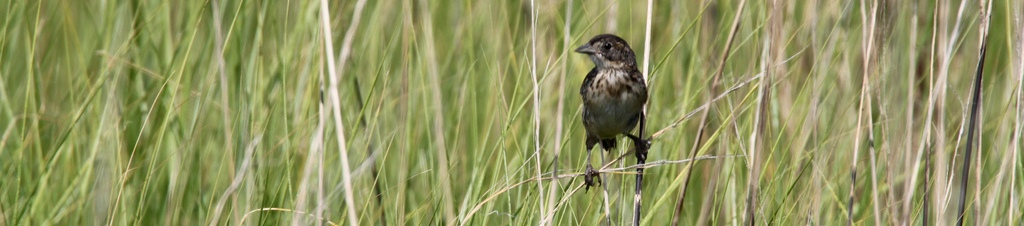
** Header Image is Seaside Sparrow by Richard E. Gibbons **