Mississippi River-Delta Groundwater-Surface Water Interaction Study
Project Sponsors: Department of the Treasury under the Resources and Ecosystems Sustainability, Tourist Opportunities, and Revived Economies of the Gulf Coast States Act of 2012 (RESTORE Act) through The Water Institute of the Gulf
Investigator: Frank Tsai (LSU)
Graduate Student: An Li
Award Length: 2017 - 2019
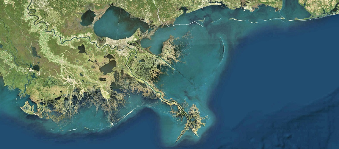
Project Summary: The Mississippi River Delta Plain is one of the largest delta plain in the world. The delta plain is formed under conjunct influence of fluvial, deltaic and marine processes, which result in a complicated subsurface setting both geologically and hydrologically. These complexity pose challenges for the planning and implementing of the multi-billion dollar project on coastal protection and restoration. However there is a lack of knowledge on how the subsurface components (stratigraphy and groundwater) interact with surface components (geomorphology, river and bay water), how they are related to land loss problem, and how they affect efficacy, durability and sustainability of the coastal protection and restoration project. My research area is in the Lower Mississippi River Delta Plain extending from Jesuit Bend, Louisiana to the head of Passes. I constructed a 3-D and regional-scale subsurface stratigraphy model using geotechnical boring data, to visualize spatial distribution of different types of sediments (sand, silt, and clay), and their relationship with topobathymetric features such as river channel, marsh surface, and dredging canals. The model extend from land surface to the bottom of the trunk Mississippi River channel (~50m). Hydrologic components (river stage and tide water level) were later added upon the stratigraphy model to simulate groundwater flow. The flow model reveal the exchanging of water between river, bay and groundwater systems. The model also reveal the response of groundwater system to hydrologic events such as flooding, storm, and hurricane. Our goal is to use the modeling tool to understand this hydrological-geological- geomechanical coupled natural system and provide engineering insight for the coastal protection and restoration projects.