LGS Releases New Digital Structure Maps for Key Louisiana Geologic Units
February 11, 2026
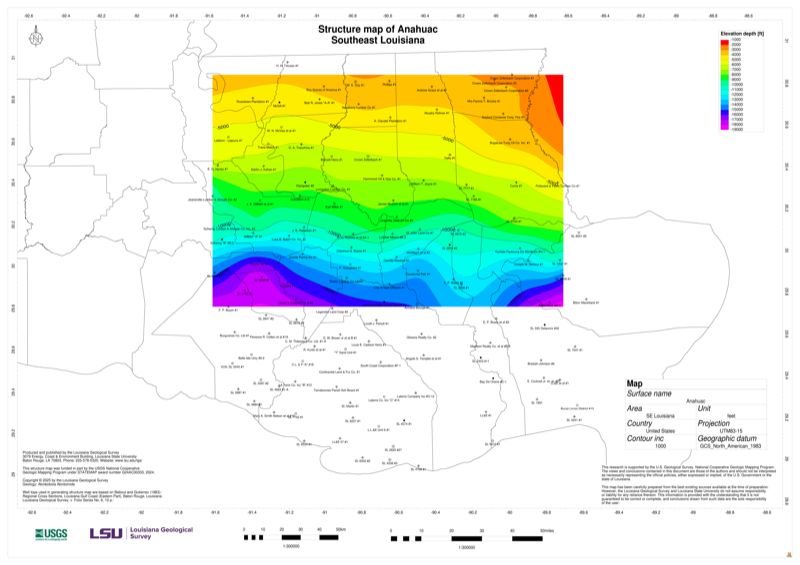
The Louisiana Geological Survey (LGS) has developed new digital structure maps for several important geologic intervals and formations across the state. The maps include the Lower Miocene, Middle Miocene, and Upper Miocene intervals, as well as major geologic formations and groups such as the Wilcox and Midway.
Developed as part of the 2024–2025 STATEMAP project, jointly funded by the U.S. Geological Survey (USGS) and the State of Louisiana, these maps provide updated tools for subsurface interpretation and regional geologic analysis. Structure maps play a vital role in understanding stratigraphy, resource distribution, and geologic history in Louisiana’s Gulf Coast region.
These digital products, along with the associated technical report, are now available for download on the LGS website, further supporting LGS’s mission to provide high-quality geoscience data to the public and professional community.