LSU Researchers Team Up to Examine Environmental Threats to Libraries, Museums, and Archives Nationwide
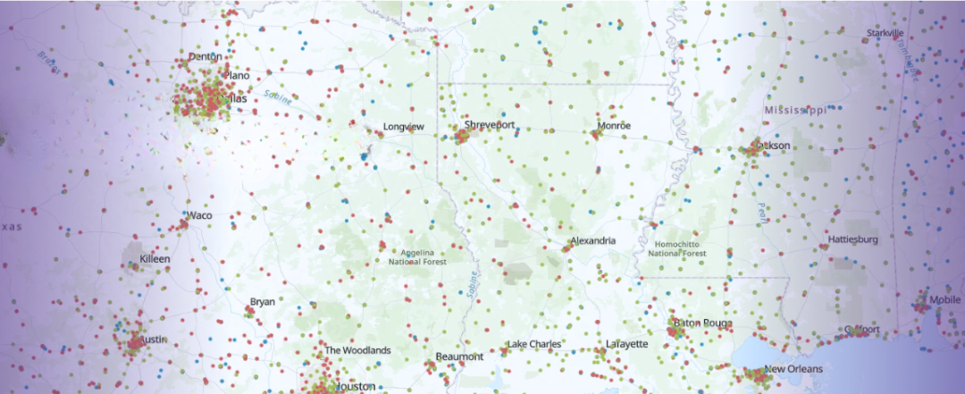
The PROTECCT-GLAM project team complied and verified a unique dataset including the georeferences for the majority of U.S. GLAMS.
Photo Credit: Image courtesy of LSU, via the U.S. GLAM Dataset
As climate-related disasters become more frequent and severe, the institutions that preserve our nation’s cultural heritage face growing risks. Researchers at Louisiana State University have received a grant from the Mellon Foundation to expand research examining how climate threats affect galleries, libraries, archives, and museums (GLAMs) across the United States. The project comes at a critical time: federal climate analyses estimate that roughly one in five U.S. parishes and counties face significant climate risk from hazards such as hurricanes, flooding, and extreme heat, placing thousands of cultural heritage institutions, and the historical collections they preserve, at increasing risk. The research will help identify vulnerabilities and resilience strategies that could benefit institutions in Louisiana and inform climate preparedness efforts for cultural organizations around the world.
The two-year, $200,000 project is led by Edward Benoit III, associate professor and director of the School of Information Studies in the LSU College of Human Sciences & Education, and Jill Trepanier, professor and chair of the Department of Geography & Anthropology in the LSU College of Humanities & Social Sciences. This research will analyze climate vulnerability and resiliency among cultural institutions located in the nation’s most at-risk areas. The work will build on an earlier federally funded project and aims to provide practical tools and best practices that help institutions safeguard their collections and continue serving their communities in the face of growing environmental threats.
Hazards such as hurricanes, flooding, extreme heat, and sea level rise pose increasing risks to cultural heritage institutions and the communities they serve. These events threaten not only the physical preservation of collections but also the infrastructure that supports libraries, archives, and museums. The LSU-led research will examine both environmental risks and social factors that influence how well institutions can prepare for and recover from disasters.
“This research addresses a critical challenge for cultural heritage institutions,” said Benoit. “Libraries, archives, and museums hold the historical record of our communities. Understanding the risks they face, and identifying practical strategies for resilience, helps ensure these collections remain accessible for generations to come.”
The project builds on the earlier PROTECCT-GLAM initiative, funded by the Institute of Museum and Library Services, which developed a national climate risk assessment scale for cultural institutions. That initial model analyzed climate variables such as hurricane wind occurrence, flash flooding, extreme heat and humidity thresholds, and projected sea-level rise to estimate environmental threat levels.
LSU researchers will expand the model by incorporating additional data on institutional infrastructure and the social vulnerability of surrounding communities. The team will focus on GLAM institutions located in the top 20 percent of the U.S. most at risk for climate threats, including 629 parishes and counties spanning both urban and rural areas.
“From a climatology perspective, understanding patterns of storm intensity, flooding, and extreme temperatures is essential to assessing risk for cultural institutions,” said Trepanier. “By pairing climate hazard analysis with geographic data on infrastructure and surrounding communities, we can better identify which institutions face the greatest exposure and what strategies may strengthen their resilience.”
Over the course of the project, date will be gathered on building age, construction type, elevation, HVAC systems, power generation capabilities, fire suppression systems, and collection storage conditions for participating institutions. Researchers will also analyze social vulnerability indicators, including factors such as poverty, housing conditions, and transportation access, using data from the U.S. Census Bureau and the Social Vulnerability Index.
Geographic information systems (GIS) technology will integrate environmental risk data with infrastructure and social vulnerability factors to refine the existing threat scale. The resulting model will help identify geographic risk assessments and highlight best practices used by the most resilient organizations.
The interdisciplinary project brings together a research team that includes faculty, graduate assistants, and undergraduate researchers at LSU. Undergraduate researchers assist in the data collection and curation, while the graduate students assist with map creation, pattern identification, and manuscript preparation. In addition, both groups assist with the creation of the GIS website for information dissemination.
This research will strengthen preparedness across the GLAM sector by offering data-driven guidance to institutions navigating increasingly complex climate challenges.