Letting Nature Lead the Fight – US Army Corps of Engineers Reinvests in LSU to Protect Military Infrastructure Using Nature-Based Designs
November 08, 2022

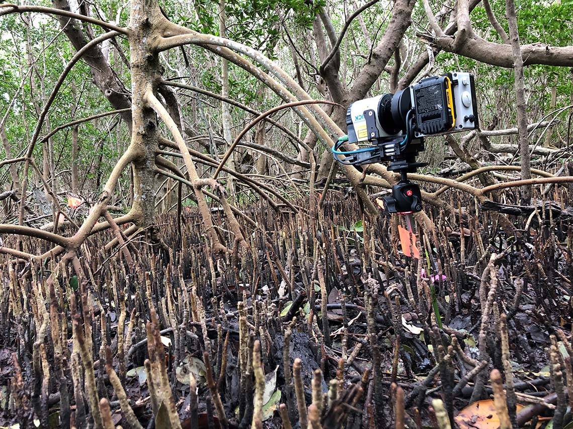
LSU researcher Elizabeth Bogan is creating 3D images of mangrove trunks and roots in order to develop a more precise means of measuring them. Mangrove root structures create a drag on coastal storms, stealing wave energy and lowering storm surge, and these characteristics make the trees excellent candidates for providing coastal protection.
– Photo Credit: Elizabeth Bogan, Andre Roavi and Robert Chancia
LSU researchers and the US Army Engineer Research and Development Center are using the Louisiana coastline as a living laboratory as they team up to develop a set of engineering and design strategies to protect the Army's infrastructure and people.
BATON ROUGE -- The benefits of coastal wetlands are widely documented—as buffers against hurricanes, as filters that clean excess nutrients out of water, as wildlife habitat. But as the threats posed by rising sea levels and other coastal hazards come into ever sharper focus, these multi-tasking landscapes, along with a diverse array of other natural features along the Gulf Coast, may become something more: protectors of the nation’s military infrastructure. And the Louisiana coast is a big part of the living laboratory which represents the challenges of a future climate.
“ This partnered project will ultimately lead to groundbreaking engineering practices that make use of innovative ecosystem design solutions to create more sustainable and resilient future coastal terrains ”
This is the idea outlined in the Developing Engineering Practices for Ecosystem Design Solutions, or DEEDS project, a partnership between LSU and the US Army Engineer Research and Development Center, also called ERDC, located in Vicksburg, MS. They will be joined by researchers from the University of Delaware as they develop a set of engineering and design strategies to protect both the Army’s coastal infrastructure and its people. But rather than relying on standard engineering practices like flood walls and drainage, the DEEDS project sets forth an ambitious agenda: to build out a library of coastal protection designs employing a set of tools both innovative and ageless—the features native to the coastal ecosystems themselves.
“This partnered project will ultimately lead to groundbreaking engineering practices that make use of innovative ecosystem design solutions to create more sustainable and resilient future coastal terrains, considering the spectrum of these challenges,” said Edmond Russo, director of ERDC’s Environmental Lab. “We are excited to partner with LSU on this project, which will directly support confident prosecution of military mission operations across a range of challenging coastal conditions.”
The DEEDS project makes full use of the wealth of coastal expertise available at LSU, including that of its newly created Coastal Ecosystem Design Studio, headed by Robert Twilley, of the Department of Oceanography & Coastal Sciences, or DOCS. Twilley, who is also LSU’s interim vice president of research and economic development, will be joined by DOCS Assistant Professor Matt Hiatt, as well as Professor of Civil and Environmental Engineering and Director of the Center for River Studies Clint Willson, and LSU AgCenter LaHouse Resource Center Director Carol Friedland, who is also a professor of biological and agricultural engineering. Assistant Professor of Architecture Traci Birch will also be joining the project, as associate director of the Coastal Ecosystem Design Studio.

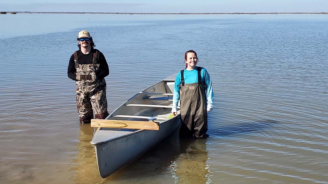
LSU Researchers on Wax Lake
– Photo Credit: Matt Hiatt
These researchers will be creating a technical process they call Collaborative Ecosystem Design, or CED. They will begin to build it by examining nature-based designs already present in the Gulf, with a strong focus on three different case studies. First, the mangrove forests of the Florida coast, where, in the wake of Hurricane Michael’s damage to Tyndall Air Force Base, trees are seen as a potential protective barrier for military infrastructure. Second, the Atchafalaya Bay and Morgan City, where the diversion of a section of the Atchafalaya River has shown the land-building powers of a river diversion to protect a coastal community. Also, the nation’s only “leaky levee,” the Morganza to the Gulf Hurricane Protection Plan levee system which shields Houma in Terrebonne Bay, where a system of navigable flood gates and locks allow tides to build wetlands.
The features at these sites all provide a similar benefit to their surrounding landscapes—they all create some measure of protection for coastal systems and military infrastructure, including wetlands, soils and built environments. In the parlance of CED, this protection is what is known as an environmental service, a function the ecosystem performs naturally, that can be deployed to greater benefit in a designed ecosystem. Once such a service has been identified, the next step for DEEDS researchers is to fully quantify all services that can be realized by specific designs, thereby connecting performance with value.
In a traditional cost benefit analysis, Robert Twilley, the author of the original DEEDS proposal noted, the primary ecosystem service would be the only thing taken into account. However, the CED process goes a step further, and measure other positive services these natural features can provide, both in terms of other environmental services known as co-benefits —say, a mangrove forest’s ability to remove carbon from the atmosphere and protect agricultural soil resources—and social benefits, such as a healthy coastal fisheries supporting vital industries and family businesses while also providing more recreational opportunities.
Measures of hazards, such as storm-damage assessments, will also be included in the CED process models. Carol Friedland said it was another way of demonstrating the value of the nature-based features: “Understanding how ecosystem design protects communities and infrastructure provides one direct measure about the value and function of natural and nature-based features.”
In the long term, such research benefits everyone, she said. “Understanding the cost effectiveness and benefits of nature-based approaches to flood mitigation will help decision-makers evaluate the full range of protective approaches to improve the long-term safety and sustainability of Louisiana residents.”
“You’re translating ecosystem performance”

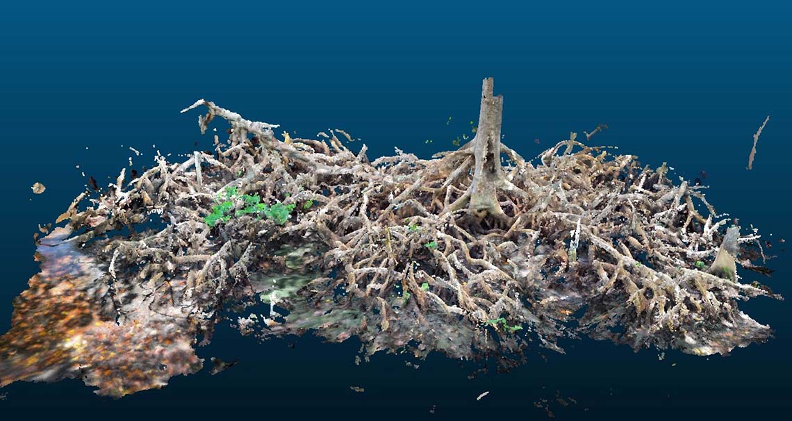
A 3 dimensional scan of a mangrove root structure
– Photo Credit: Elizabeth Bogan, Andre Roavi and Robert Chancia
DEEDS pairs with another ongoing LSU-Army collaboration, Anticipating Threats to Natural Systems, or ACTIONS. In that project, researchers are cataloging and analyzing existing and potential hazards on Louisiana’s coastlines as sea levels rise and the climate changes. The knowledge built as they do this is integral to DEEDS, said Twilley. It informs the design processes researchers are trying to construct, as they attempt to create comprehensive resources for the military. “You go from engineering and ecology through construction management and urban planning,” he said.
Overall, it’s a process he describes as translation: “You’re translating ecosystem performance into a human language,” he said. “You take the way an ecosystem performs and the services it provides, and translate this knowledge into what it means to people, and how it changes their behavior.”
In the DEEDS project, the primary goal for each case study site is the same—quantify the ways a particular feature provides coastal protection. But the measures used to reach the goal at each site vary greatly, and their level of detail serves to demonstrate just how comprehensive the DEEDS project intends to be.
Take Elizabeth Bogan, a graduate student in civil and environmental engineering at LSU. Bogan studies red mangroves on the Florida shoreline. The trees’ elaborate, tangled root systems create a drag during a coastal storm, stealing wave energy, lowering storm surge, and protecting soil and wetland resources and military infrastructure. However, the roots are difficult to measure, meaning their ability to slow a coastal storm has been historically difficult to quantify.
Bogan, however, is working to develop a method to relate tree trunk size to root volume: “I use Lidar to create a 3D image of individual tree trunks and roots,” she said. The goal is to correlate these measurements with information about coastal storm surges and wave reduction, eventually creating a model with accurate estimates about precisely how much protection mangroves can provide.
Such a comprehensive study will not only make the CED process more effective, it will provide co-benefits to the sites themselves as well.
Terrebonne Levee and Conservation District Executive Director Reggie Dupre said he hopes working with the DEEDS project will facilitate improvements in his district’s levee management. Working with such a massive amount of water requires identifying best practices for things like when to release water from the lock in a given situation. It’s a process known as adaptive management, and Dupre hopes knowledge gleaned from the DEEDS project can help his district build capacity for it.
“We have seen tremendous environmental benefits”
Dupre noted that wetland ecosystems within the levee had improved since its construction. When the levee structure was first built, saltwater intrusion along the coast had left the Terrebonne and Lafourche parishes with some of the worst wetland losses on the planet.
“When we built the hurricane protection levee and put in the environmental structures, it changed the salinity of the wetlands on the inside of the levee, to the point where they started to recover,” Dupre said. “We have seen tremendous environmental benefits.”
This is the sort of environmental co-benefits that DEEDS researchers are looking to include in their analyses. Hiatt sees the study of the hydrology of still-growing wetlands as another opportunity to fully quantify benefits that currently may not be fully understood. “We have a pretty good handle, as a scientific community, on what will form if you have a sediment diversion, but less of an understanding of how, as it forms, these co-benefits will change,” he said. “It has so many implications for things like nutrient removal, and the prevention of algal blooms.”
Dupre said he hopes the DEEDS project will be able to provide some independent analysis of the changes his area is witnessing, and demonstrate the impact projects like this can have: “This goes beyond the coast.”