WAVCIS: Wave-Current-Surge Information System
March 07, 2022
Excerpt from From Air to Land to Sea: 50 Years of Educating Coastal Leaders (publication forthcoming)
By Chunyan Li
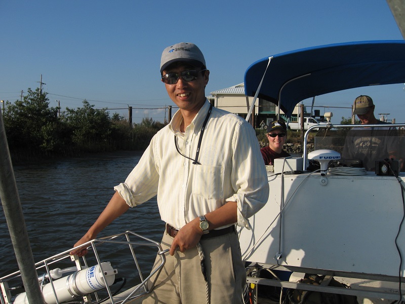
Chunyan Li working in coastal waters in 2006
– Chunyan Li
Ocean observing data provides essential information to support human and marine life, coastal economies, and a healthy, sustainable environment. One of the ways that LSU observes the ocean is through the offshore observing system for weather and oceanographic data, Wave-Current-Surge Information System (WAVCIS).
First established in 1997, WAVCIS data include a time series of wind direction and speed, air pressure, air temperature, humidity, wave height, wave periods, vertical profiles of horizontal current velocity, storm surges, etc. WAVCIS deploys acoustic equipment on the water and under the water to provide continuous real-time coastal ocean met-ocean data from observations and modeling to serve research, industry, coastal management, education, and for preparation and coping with extreme weather and events, as well as long-term climatological variations. Data are either transmitted through the Gulf of Mexico Coastal Ocean Observing System (GCOOS) to the National Oceanic and Atmospheric Administration (NOAA) on a real-time, hourly basis, or archived in its data server. WAVCIS facilities include an offshore real-time observing system that is part of the U.S. Integrated Ocean Observing System (IOOS/GCOOS) system, a data server, and a cluster computer system (for numerical simulations using the Finite Volume Community Ocean Mode (FVCOM), and weather predictions using Weather Research and Forecasting (WRF), a real-time weather forecast model updated continuously covering the northern Gulf of Mexico).
With funding from the National Science Foundation, WAVCIS is currently deploying instruments at several locations in the inner shelf and mid-shelf regions for quasi-continuous collection of data for meteotsunami and storm surges in the Gulf of Mexico. These data are from instruments deployed at the seafloor and retrieved periodically using one of two research vessels, the RV Pelican or RV Acadiana. Although not transmitted in real-time to NOAA, they have captured many recent major storms and hurricanes, including Hurricanes Laura and Delta. Damages to WAVCIS facilities and instruments are frequent challenges, especially during severe weather events.
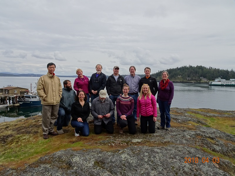
April 3, 2018: -Seattle, WA: The major participants of the Arctic project included people from University of Alaska, NOAA, Florida International University, and Louisiana State University.
– Chunyan Li
Furthermore, WAVCIS research extends far beyond the Gulf of Mexico. For example, it has also been involved in a couple of projects studying the arctic lagoon interaction with the Beaufort Sea. Numerical simulations and observed data have shown strong evidence of a warming trend in the study area of the arctic region. This warming trend is leading to a significant change in freshwater contents in part of the regions, including the LSU study site. WAVCIS deployed several instruments and conducted vessel-based surveys in the region and conducted numerical model simulations, using two advanced numerical models, Delft 3D and FVCOM, to study the impact of the arctic low atmospheric pressure systems and associated storms in driving the water exchange between the coastal Beaufort Sea and arctic estuaries.
WAVCIS data have been used by students and researchers and have resulted in numerous dissertations, conference presentations, and peer-reviewed publications in physical oceanography and other disciplines. The platforms in Louisiana coastal waters are also used by collaborators for measurements of optical parameters and biological parameters (e.g., for hypoxia). In summary, data provided by WAVCIS are used to advance knowledge about our oceans.